Most viewed - Danny Yates
|
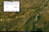
DY-31c.JPGThen and Now106 viewsNext, I went on Google Earth to look at that location. In this screen print, you can find the same notch. I then used the mileage feature on Google Earth to measure the exact distance from that location back to the intersection where Hwy 19 and Hwy 14 split. I showed that picture to our driver so he could measure the distance on the odometer. Again, it's not a dramatic comparison, but the topography is the same. I
had a lot of fun just preparing for the trip.
|
|
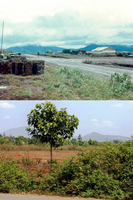
DY-32c.JPGThen & Now: the search for Base Camp106 viewsSo here is a then and now of our base camp.
|
|
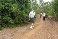
DY-Nam2.jpgBack in Nam again106 viewsDanny Yates walking down a trail near the former LZ Uplift.
|
|
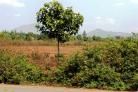
DY-32d.JPGThen & Now: the search for Base Camp105 viewsUnfortunately, when we got there, we found it was a restricted area (we couldn't even stop for pictures), so the attached picture is the best I could come with. Oh, how I would have liked to have been able to walk around that hill once more.
|
|
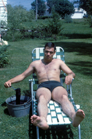
OD_Underwear.JPGOlive Drab Underwear105 viewsWell, I wasn't issued any OD underwear, so I had to "make" my own by dipping some in green dye prior to departing for Nam. Many of us, if not all, did not know what to pack for Vietnam.
|
|
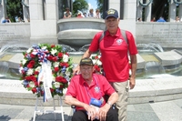
WWII_Memorial.jpgHonor Flight105 viewsLaying of a wreath at the WWII Memorial in Washington, DC during the weekend of June, 2015, 71 years after the D-Day landing.
|
|
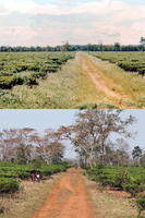
DY-37.JPGThen and Now104 viewsThis is the tea plantation --it's still there, too--south of Pleiku along Hwy 19. About the only change is the trees have grown.
|
|
IMG_3434.jpgJust a few years later103 viewsSame area, just an older soldier.
|
|
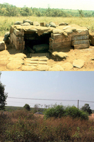
DY-31a.JPGThen and Now102 views{First, go to Tab 1 and locate this bunker photo. It is in the 2nd row}
This is probably the least dramatic of my comparison pictures, but it means a lot to me because of the way I was able to find the location. The location is on Hwy 19, south of Dragon Mountain, near the Tea Plantation. Go to the map next.
|
|
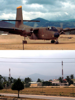
DY-28.jpgThen and Now101 viewsHere is a comparison picture of the airstrip in Duc Pho. I wasn't able to make an exact comparison because I couldn't get to the other side of the runway, as it is a restricted area, but it is close enough to see how the area has changed. {However, the background is unmistakable!)
|
|
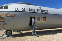
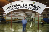
IMG_5743.jpgThis was the "Freedom Bird" for me100 viewsMany of us came home to Travis AFB aboard C-141's. It was a real hoot to go back there
and take a tour of one of those planes. I've included a picture of me and the C-141 I came home on. It was taken at Clark AFB in the Philippines.
|
|
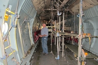
IMG_5725.jpgInside the Freedom Bird100 viewsChecking the accommodations for servicemen returning home.
|
|
|
|
