|
|
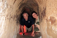
Tunnels.jpgVietnam: 2012 visitHere are a couple of pictures from our tour of the Cu Chi Tunnels.
Tunnels: My wife, Linda, and I explore a short portion of the tunnels.
Pretty creepy.Apr 19, 2012
|
|
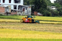
The_new.jpgVietnam: 2012 visitThe New: This is a new rice combine. They are making progress.Apr 19, 2012
|
|
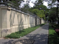
Embassy_Wall.jpgVietnam: 2012 visitEmbassy Wall: This is the wall that surrounded the US Embassy during the war. It was on the rooftop of the embassy that we remember helicopters flying US personnel and Vietnamese trying to flee the onrush of the North Vietnamese Army in 1975. That building has been torn down, and a US Consulate Building erected in its place.Apr 19, 2012
|
|
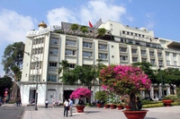
Rex_Hotel.jpgVietnam: 2012 visitRex Hotel: We stayed in the Rex Hotel in Ho Chi Minh City. The rooftop bar was a favorite watering hole for reporters and soldiers during the war.Apr 19, 2012
|
|
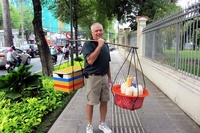
Street_vendor.jpgVietnam: 2012 visitStreet Vendor: I tried my hand at street vending, but decided retirement was still the best option for me!Apr 19, 2012
|
|
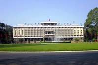
Reunification_Palace.jpgVietnam: 2012 visitReunification Palace: I can still remember the sight of North Vietnamese tanks crashing through the gates of this building that once was the government building of South Vietnam. Those tanks are still on the grounds.
Apr 19, 2012
|
|
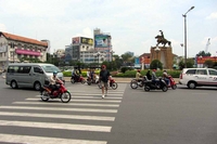
Crossing_the_street.jpgVietnam: 2012 visitCrossing the street: This is the correct way to cross the street in Saigon (now called Ho Chi Minh City). Look straight ahead and keep moving. Don't stop or make any sudden movements, and all those vehicles WILL miss you. It takes a little time to get used to it, and a lot of faith, but it works. I think the Vietnamese have only one traffic rule: Try not to run over the tourists.Apr 19, 2012
|
|
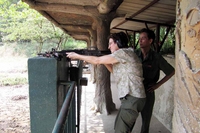
M-16.jpgVietnam: 2012 visitM-16: My wife squeezes off a few rounds from an M-16. Note Vietnamese observer.Apr 19, 2012
|
|
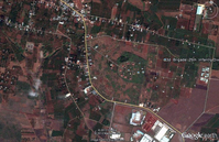
DY-32b.JPGThen & Now: the search for Base CampI went on Google Earth, with the photo tab on, and found this screen shot of Engineer Hill. I highlighted one of the picture icons so you can see the 3rd Brigade, 25th Inf Div label. All of the photos submitted at this location are labeled that way.Apr 15, 2012
|
|
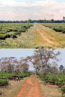
DY-37.JPGThen and NowThis is the tea plantation --it's still there, too--south of Pleiku along Hwy 19. About the only change is the trees have grown.Apr 15, 2012
|
|
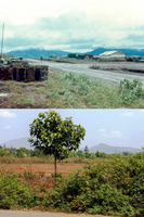
DY-32c.JPGThen & Now: the search for Base CampSo here is a then and now of our base camp.Apr 15, 2012
|
|
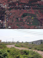
DY-32e.JPGThen & Now: the search for Base CampOur guide pointed out this road leading into our base camp area. Something about that looked awfully familiar. I've attached the picture along with a Google Earth screen print, marked with an "x" to show where the picture was taken. So close, and yet so far.
According to my letters home, base camp moved to an area south of Pleiku, probably Enari, in May of 1967.
Apr 15, 2012
|
|
| 4987 files on 416 page(s) |
 |
 |
 |
 |
 |
202 |  |
 |
 |
 |
|
